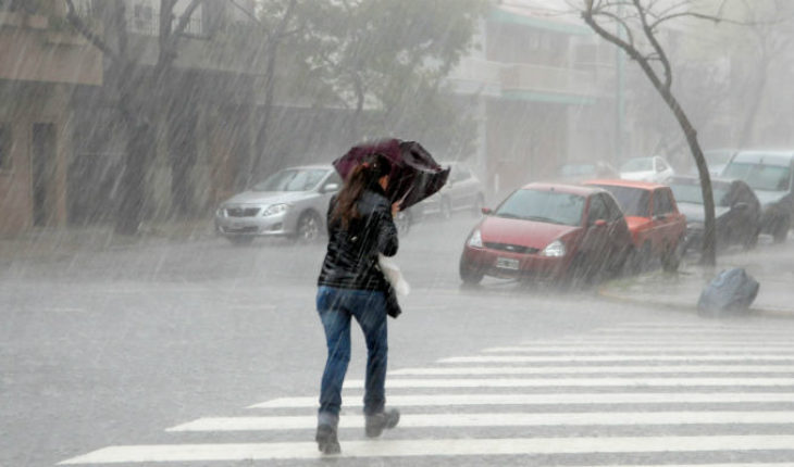
photograph / the convener tropical wave No. 34 will travel over Western Mexico, while parts of upper atmospheric instability will affect the States of North, Northeast and Southeast of the country, In addition to the inlet of warm and humid air from both oceans, they shall foster the following potential of rain, which will be accompanied by electrical activity, strong winds and possible hail.
Note: Hurricane “Norman” in the Pacific Ocean, decreasing to category 2 on the Saffir-Simpson scale, was located 1,460 km southwest of Cabo San Lazaro, B.C.S., with winds of 175 km/h, gusts of 215 mph. While the “diecisiete-e” Tropical Depression was 715 km southwest of Manzanillo, Col., with winds of 55 km/h and gusts of 75 mph.
(accumulated in 24 h) maximum precipitation forecast for today, 01 September 2018: very strong isolated thunderstorms intense (75 to 150 mm): Oaxaca and Chiapas.
Isolated strong storms very strong (50 to 75 mm): Sonora, Chihuahua, Durango, Sinaloa, Nayarit, Nuevo León, Tamaulipas, Puebla and Veracruz.
Intervals of showers with isolated strong storms (25 to 50 mm): Jalisco, Colima, Michoacan, Guerrero, Zacatecas, Guanajuato, Queretaro and Tabasco.
Rain with squalls (5.1 to 25 mm) in areas of intervals: Baja California Sur, Coahuila, San Luis Potosí, Aguascalientes, Hidalgo, Tlaxcala, State of Mexico, city of Mexico, Morelos, Yucatan and Quintana Roo.
Isolated (0.1 to 5 mm) in areas of rainfall: Campeche.
Note: storm areas may be accompanied by lightning, falling hail, strong gusts of wind, as well as possible development of storms or eddies in the North and northeast of the country.
forecast temperatures for today 01 September 2018: maximum temperatures of 40 to 45 ° c areas of Baja California, Baja California Sur, Sonora, Sinaloa, Coahuila, Nuevo León, Tamaulipas and Michoacán.
Maximum temperatures of 35 to 40 ° C: areas of Nayarit, Jalisco, Colima, Guerrero, Oaxaca, Chiapas, Chihuahua, Durango, Zacatecas, San Luis Potosí, Hidalgo, Morelos, Veracruz, Tabasco, Campeche, Yucatán and Quintana Roo.
forecast winds for today 01 September 2018: strong winds with gusts equal to or exceeding 50 km/h in areas of Baja California, Sonora, Chihuahua, Durango, new León, Coahuila, Tamaulipas, Zacatecas, Jalisco, Oaxaca and Chiapas.
forecast by region:
Valley of Mexico: partially cloudy skies during the day, in the afternoon will increase cloud cover expected intervals of showers with thunderstorms in the city of Mexico and State of Mexico. The wind will be North of 10 to 25 km/h. The city of Mexico provides for a maximum temperature of 24 ° c to 26° C and a minimum of 13 to 15° C. For the State of Mexico, maximum temperature of 22-24° C and a minimum of 8 to 10° C.
Baja California Peninsula: clear sky most of the day, in the afternoon will increase cloud cover and recorded intervals of showers in Baja California. Hot environment and wind from the North and Northwest at 15 to 30 mph, with gusts of up to 50 km/h in Baja California.
North Pacific: Sky cloudy afternoon, with very strong specific storms accompanied by electrical activity possible hail in Sonora and Sinaloa. Hot environment and wind from the West and southwest at 15 to 30 km/h, with gusts that may exceed the 50 km/h in Sonora.
Pacific Center: Sky cloudy in the afternoon with isolated storms very strong in Nayarit and Jalisco, Colima and Michoacan, forts which will accompany electrical activity and possible hail. Warm atmosphere and wind of variable direction of 15 to 30 km/h, with gusts that can exceed 50 km/h on coasts of Jalisco.
South Pacific: Sky cloudy in the afternoon with the potential of intense isolated storms in Oaxaca and Chiapas, as well as strong in Guerrero, accompanied by electrical activity and possible hail. Warm atmosphere and wind direction variable of 15 to 30 km/h, with gusts of up to 50 km/h in Oaxaca and Chiapas.
Gulf of Mexico: cloudy skies in the afternoon with isolated storms very strong in Tamaulipas and Veracruz, as well as strong in Tabasco, accompanied by electrical activity. Warm atmosphere and wind from the East and Southeast of 20 to 35 mph, with gusts of up to 50 km/h in Tamaulipas.
Yucatan Peninsula: Sky cloudy in the afternoon with intervals of showers in Yucatan and Quintana Roo, accompanied by electrical activity, as well as rain isolated in Campeche. Hot environment and wind of the East and northeast of 15 to 30 km/h. table of the North: in the afternoon is expected point very strong in Chihuahua, Durango and Nuevo Leon, isolated strong storms in Zacatecas, in addition to intervals of showers in Coahuila, San Luis Potosí and Aguascalientes, accompanied by electrical activity and hail. Warm atmosphere and wind direction variable from 20 to 35 km/h in the region, with gusts exceeding 50 km/h in Chihuahua, Durango, new Leon, Zacatecas and Coahuila.
Central table: Sky cloudy in the afternoon with specific very strong in Puebla, isolated strong storms in Querétaro and Guanajuato, and intervals of showers in Hidalgo and Tlaxcala, accompanied by electrical activity and hail. Warm atmosphere and wind of variable direction of 15 to 30 km/h, with gusts that may exceed the 45 km/h in storm zones.
Source: Conagua


