On this day, the subtropical jet stream in the northwest of the country; a dry line in northeastern Mexico; low pressure channels in the north, west, east, southeast and Yucatan Peninsula; tropical wave No. 6, which will move south of the Yucatan Peninsula; the entry of moisture from the Pacific Ocean, Gulf of Mexico and Caribbean Sea; as well as instability in high levels of the atmosphere, will cause intense point rains in Chiapas, very strong in Oaxaca, Tabasco, Campeche and Quintana Roo; forts in Chihuahua, Durango, Guerrero, Veracruz (south) and Yucatan; as well as showers in northwest, northeast and western states. Likewise, winds with gusts of 60 to 80 km / h and tolvaneras are forecast over the northwest, north, northeast and west of Mexico, in addition to winds with gusts of 40 to 60 km / h and possible tolvaneras in the east, center and southeast, including the Valley of Mexico and the Yucatan Peninsula. All rains could be accompanied by electric shocks, strong gusts of wind and possible hail; In addition to causing an increase in the levels of rivers and streams, as well as landslides and floods. Finally, the anticyclonic circulation in medium levels of the atmosphere will maintain the third heat wave over the Mexican territory, with temperatures above 45 ° C in Sonora, Coahuila, Nuevo León, Tamaulipas, San Luis Potosí, Veracruz and Tabasco.
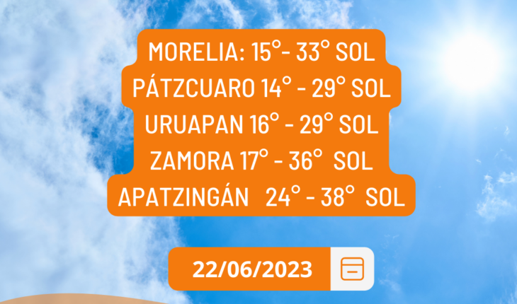
Clear skies and high temperatures for Michoacan
June 22, 2023 |


